
Show clients exactly where the drone was.
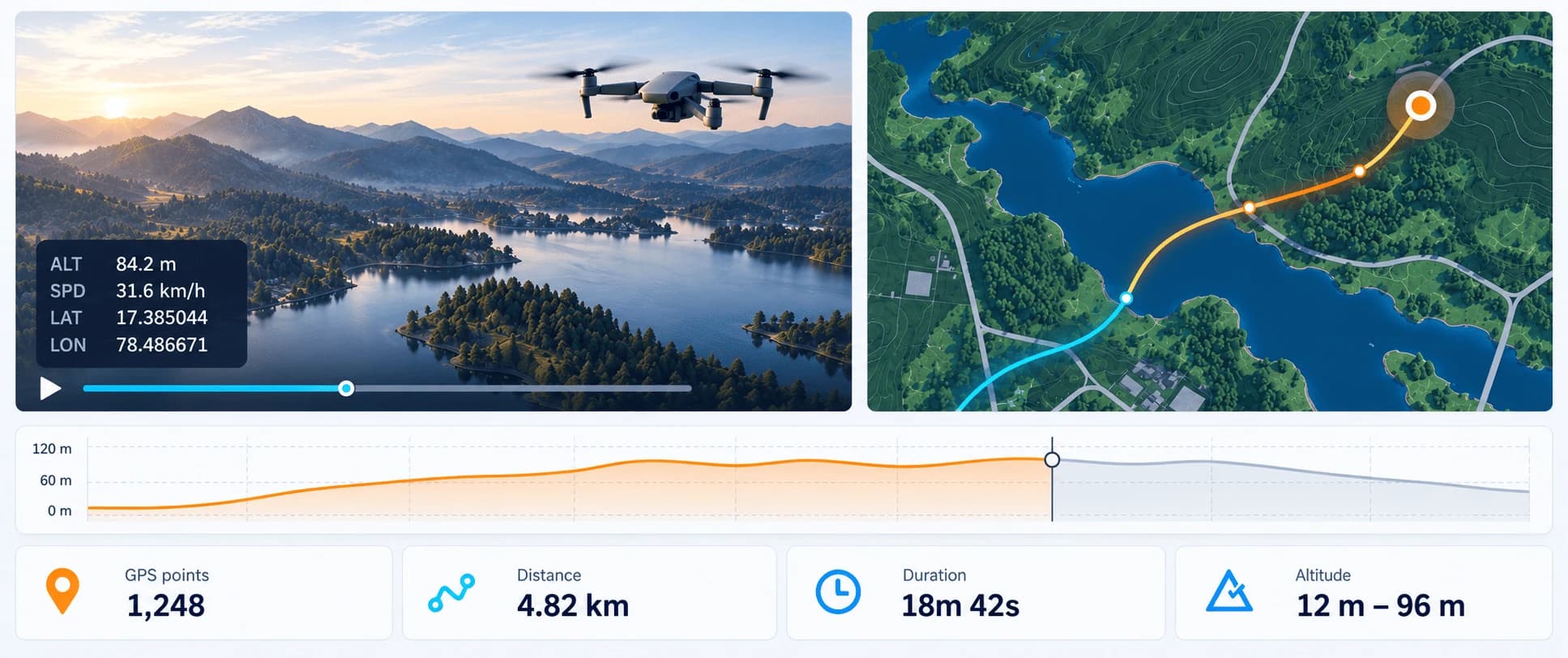
Aeroxpress pairs your DJI video with its SRT flight log. It plays the footage next to a live flight path, altitude and speed, then shares it with a link or exports an MP4 with the data burned in.
- Free Flight Viewer
- Nothing uploaded
- Self-hostable with Docker
Built for
Teams who fly for a living
Wherever a client needs to know where a shot was taken, Aeroxpress turns the flight log into proof.
- 01
Survey & mapping
Hand over every flight with its exact track, altitude and GPS coverage, not just the footage.
- 02
Infrastructure inspection
Jump to the second a defect appears and show exactly where on the asset it was filmed.
- 03
Construction progress
Fly the same route every week and send stakeholders a link that shows what changed and where.
- 04
Real estate & film
Deliver clips with altitude, speed and a mini-map burned in, ready for listings and edits.
- 05
Agriculture
Tie crop observations to field positions and heights, and share them with agronomists by link.
- 06
Training & incident review
Replay a flight second by second with altitude, speed and heading to debrief pilots.
Features
Everything the flight log knows, next to the footage
DJI records where the drone was for every second of video. Aeroxpress puts that data where people can use it.
Flight path, synced to the frame
Every moment of the video maps to a GPS position. Scrub the video and the drone moves on the map; click the map and the video jumps there.
Overlays burned into the MP4
Place a telemetry panel, mini-map, heading indicator, logo and markers on the frame, then export a video that plays anywhere.
Altitude and speed graphs
Optional graph widgets show the whole flight profile with a live cursor, in the browser and in the exported video.
Temporary client links
Send a link that opens in any browser: no client account, no dashboard. Links expire on their own and you can revoke them anytime.
Reads real DJI flight logs
Bracket-style logs from Mini, Air and Mavic, older GPS(…) logs from Phantom and Inspire, and Enterprise logs with gimbal data.
Private by default
The free Flight Viewer plays files straight from your device and uploads nothing. Shared projects are only reachable through their link.
How it works
From SD card to client in three steps
- 01
Drop the MP4 and SRT
Take both files from the drone's SD card. Matching names like DJI_0042.MP4 and DJI_0042.SRT pair automatically.
- 02
Check the flight, design the overlay
Aeroxpress parses the flight log, validates GPS, and shows you the path, stats and a live preview of your widgets.
- 03
Share a link or export
Email your client a temporary link, or export an MP4 with the telemetry embedded, to share however you like.
Privacy & security
Drone footage is sensitive. We treat it that way.
Industrial sites, private property and critical infrastructure deserve more than a public video link.
Local viewer
The Flight Viewer never uploads your video or flight log. It all runs in your browser.
Unguessable links
Share links use 256-bit random tokens, expire on schedule and are never indexed.
Your projects only
Each account sees only its own projects. Admin actions are recorded in an audit log.
Self-hostable
Run Aeroxpress on your own server with Docker, your own storage and your own SMTP.
FAQ
Questions pilots ask
Which files do I need?
The MP4 (or MOV) video and the .SRT file your DJI drone writes next to it. Turn on “Video captions” in DJI Fly or DJI Pilot so the SRT is recorded. An SRT on its own is enough to see the flight path in the Flight Viewer.
Which drones are supported?
Any DJI drone that writes an SRT flight log: the bracket format used by Mini, Air, Mavic and Avata models, the older GPS(…) format from Phantom and Inspire, and Matrice/Enterprise logs. Unknown fields are ignored instead of breaking the import.
Do my clients need an account?
No. A share link opens a read-only page in the browser with the video, the synced map, graphs and telemetry. You choose how long it lasts (1 to 30 days) and whether the exported video can be downloaded.
Does the Flight Viewer upload my footage?
No. The Flight Viewer reads the SRT and plays the video from your device. Only map tiles are fetched from the map provider, which reveals the area you're looking at but not your files.
What if my SRT has no GPS?
Some recording modes write telemetry without a satellite fix. Aeroxpress says so clearly and still shows altitude, camera settings and the rest of the data it found.
Is Aeroxpress open source?
Yes. The full source code is on GitHub under the MIT license. Read it, run it, or adapt it to your own workflow.
Can we run it on our own servers?
Yes. Aeroxpress ships as a Docker image with FFmpeg included, stores everything on a local volume, and sends email through your own SMTP server.
Your next flight deserves more than a video file
Create an account, drop in an MP4 and its SRT, and send your client a link in minutes.